Know what you are flying over.
Groundtrack is an atlas for the window seat. It names the peaks, cities, rivers and coastlines underneath the aircraft, says which side to look out of, and does all of it with the radios off. On the iPhone, on the iPad, and — with no map at all — on the wrist.
Not on the App Store yet. There is nothing to pre-order and nothing to sign up for. The build you can install today is the iPhone one — what that leaves out is said plainly rather than left for you to find.
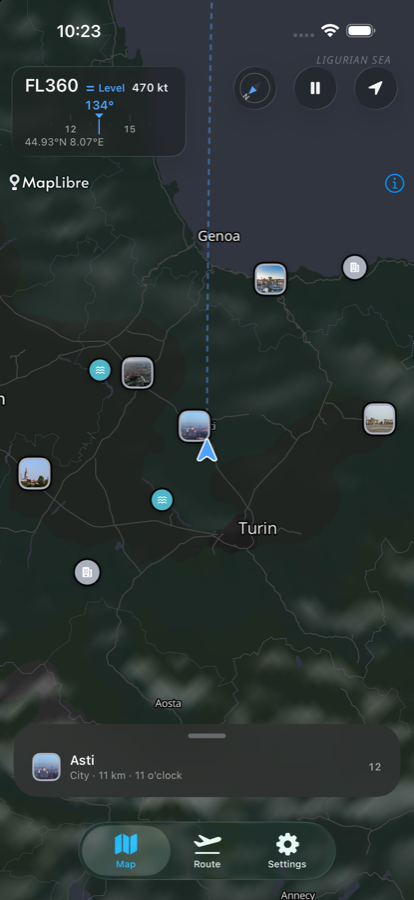
- Your position never leaves the device.
- No account needed. Not to install it, not to use it.
- No advertising, and nothing that follows you.
- 7,764places, each with the one number that defines it
- 714photographs, each with its photographer and licence
- 6languages, never machine translated
- 0adverts, trackers and accounts you have to create
The feed
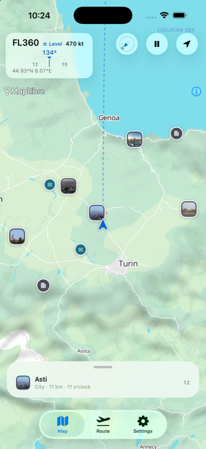
Twelve places out of the window, in the order you could actually pick them out.
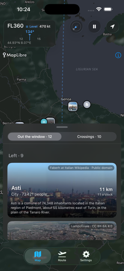
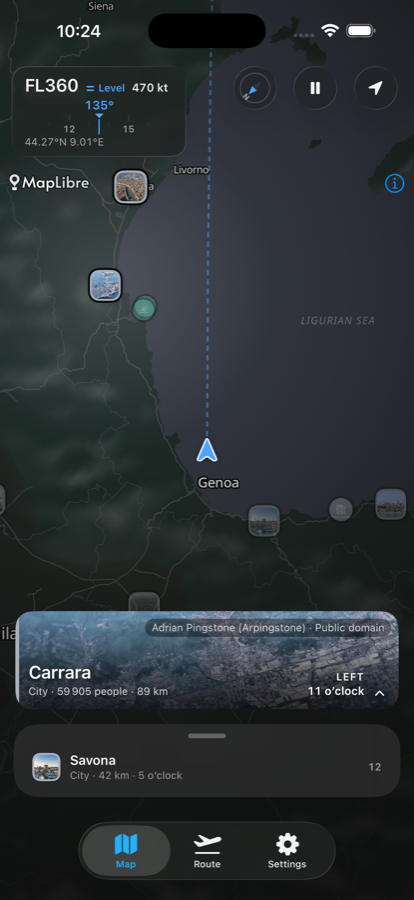
Not everything within the horizon — everything worth turning your head for. The feed ranks what is visible from your altitude, tells you which side of the aircraft it is on and how far away it is, and marks anything already behind you as passed rather than offering it as something to look at.
- Left and right, split, so you know before you lean across someone.
- A sentence for every place, written in advance and reviewed. Nothing is written in the air, so nothing invents a fact to read to a cabin.
- Every photograph carries its photographer and its licence, on the card.
Tap anything
Which side, how far, and what it actually is.
Tap a place on the map or in the feed and it lights up: the side of the aircraft, the distance, the clock position, and the one number that defines the thing — a city's population, a peak's height, a river's length. Peaks, cities, rivers, lakes, islands, glaciers, volcanoes, straits, capes, ruins.
- Colour says which family a place belongs to; the symbol says what it is. Two channels, so the map still reads on a sun-washed screen and for someone who cannot separate the hues.
- Nothing is a teardrop pin — half the Alps sit within a few pixels of each other at cruise scale.
Before you fly
Download the corridor. Then fly it with the radios off.
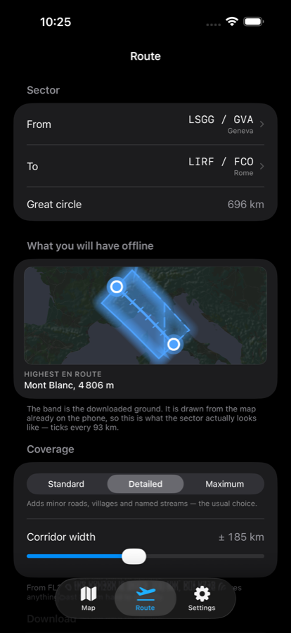
The world map and the whole catalogue are on the phone the moment you install it. Before you fly, pick a departure and an arrival, and Groundtrack downloads a band along the great circle — map, shaded relief and photographs for that stretch, in detail.
- The bundled world is coarse on purpose — enough to see where you are anywhere on earth, and a long way short of naming the valley. The sector download is what makes a stretch detailed.
- Geneva to Rome is 696 km of corridor, sized before you commit to the download.
- In the air it needs nothing at all: no mobile data, no wi-fi, nothing to log in to.
- Crossings still ahead, with the time to run — countries, seas, straits, flight information regions, the Equator, the tropics, the date line.
Day and night
Two real maps, not a tint.
The light scheme is a different map, drawn to be read in a cabin full of daylight, rather than the night map with the brightness turned up. The app follows the system, or you can pin it to one.
- Shaded relief, the track you have flown behind you, and the sector ahead.
- Everything scales with Dynamic Type.
Six languages
Never machine translated.
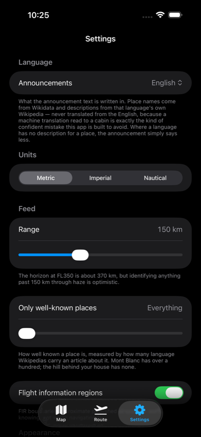
English, French, Polish, German, Spanish and Italian. Place names come from each language's own Wikipedia, and so do the descriptions — never translated from the English, because a confident mistranslation read out to three hundred people is exactly the failure this app is built to avoid.
- Where a language has no description for a place, the announcement says less instead of guessing.
Three devices
One answer, on whichever screen you are looking at.
The iPad is not a stretched phone and the watch is not a port. One of them got a layout of its own; the other got a different product, because the thing the phone app mostly is — a map — cannot exist on a wrist.
iPhone
The map, the feed, the route, the crossings. Portrait only, because a window seat is not a desk and the other hand is usually holding something. This is the app the rest of this page is about, and it is the one you can install today.
iPad
A three-detent sheet dragged with a thumb is the right control at 402 points wide and the wrong one at 1,032. So at full width the feed stops being a sheet and becomes a 380-point panel down the side, with the map taking everything else. Landscape or portrait. In a narrow split view you get the phone's sheet back, which is correct.
Apple Watch
No map — watchOS cannot run the map engine, and pretending otherwise would have meant a worse version of the good part. What is on the wrist is the answer in words, and nothing else. How that works.
Two of these three are not in the build you can install today. The TestFlight build on offer is number 5, from 16 September, and it is the iPhone app. The iPad layout and the watch app are written and tested; they arrive in the next build. This page says so here rather than letting you find out after installing.
On the wrist
No map. That turns out to be most of the point.
What survives without one is the half you act on: what is out of the window, which side of the aircraft it is on, how far away it is, and what you are about to cross. The top six of the twelve the phone has ranked, and the next crossing with the time to run.
Everything is formatted on the phone before it crosses. The watch is handed “11 km” and “11 o'clock” rather than a distance in metres and a bearing — it has no catalogue, no language table and no rounding rules of its own, so two devices in the same cabin cannot disagree about the same hill.
The phone leaves one pending answer for the watch to collect when it next wakes, rather than trying to reach it. A phone face-down in a seat pocket at FL360 is the normal case here, not a failure, and the watch never asks for anything.
Past three minutes without a word it stops answering altogether. At 470 knots a three-minute-old answer is twenty-three miles wrong, and a wrong answer stated confidently is the thing this app is built not to do.
| “Out of touch with your phone. Wake it to catch up.” | Nothing has arrived for three minutes. Anything still on screen would be wrong by now. |
|---|---|
| “Waiting for a position.” | The phone is there and does not know where it is yet. |
| “Nothing in range.” | The phone knows exactly where it is, and there is genuinely nothing worth naming. |
The last two were one sentence at first. They are opposite claims — one says the window is worth looking out of, the other says nobody looked.
Also in there
Smaller things that took the longest.
Crossings, with the time to run
Countries, seas, straits, flight information regions, the Equator, the tropics, the date line — each with how long until you reach it. Built from 963 polygons.
Notability, not everything
Places are ranked by how many language Wikipedias carry an article. It is the field that separates Mont Blanc from an unnamed 3,000 m summit, and it is why the feed reads as curated rather than dumped.
An honest horizon
From FL350 the horizon is about 370 km, but identifying anything past 150 km through haze is optimistic. The ranking knows that.
Numbers that do not shuffle
Distance, level, speed and clock position are set in monospaced digits, so they do not jump sideways while you watch them.
What it collects
Your position is read on the device, and never leaves.
That is the sentence that matters, and it is the one iOS itself shows you in the permission dialog. The app works out what is visible from where you are, and then the position is gone — not uploaded, not logged, not stored between sessions.
The app does count which screens get opened, through Google's Firebase Analytics. That is worth saying out loud rather than hiding behind “privacy-first”: five events exist, they are listed in full in the policy, and none of them is able to carry a position — not as a promise, but because no such field exists in the code and a check refuses a build that adds one.
- No account neededNothing to register, no password to lose. The next build offers Sign in with Apple — optional, never a gate, and it asks for a name rather than an email address.
- No advertising identifierThe library that would link one is deliberately not included, which is why you never see the “allow tracking” prompt.
- No route historyThere is no flight log to leak, because none is ever written.
- One caveat, statedGoogle's servers see the IP address the request came from, as any server does, and derive a rough location from it. That is the network you are on, not the position the app reads.
- This page, tooNo cookies, no scripts, nothing loaded from any other domain. Open the network tab and count — that is the whole argument.
What it is not
Not an EFB, and not a navigation aid.
Nothing in Groundtrack is certified, current, or fit for flight operations. It is a passenger-window atlas that happens to work in a flight deck, and company policy on personal devices governs whether a phone belongs in one at all.
Airspace boundaries approximate published airspace. That is good enough for “we enter the Milan FIR in about five minutes” and not good enough for anything operational.
Places are held as points, so a distance to something large is approximate by construction. And the data goes stale: a map built last year describes last year.
Where it came from
A small thing, built properly.
Groundtrack started as something to use on a flight and grew into an app because the answer to “what is that mountain?” turned out to be a genuinely hard problem: a horizon calculation, a spatial index, a notability ranking, and 714 photographs that each have to carry their photographer's name.
It is not backed by anyone, it does not need a server to work, and it has no growth team. That is why the privacy claims on this page are shaped the way they are — there is no business model here that would be served by knowing where you fly.
There are no star ratings or press quotes on this page because there are none yet. When there are, they will go here, and they will be real.
Getting it
Not out yet.
Groundtrack is in testing. It is not on the App Store, and this page is not a waiting list — there is nothing here that collects your email address, which would be an odd way to open a conversation about privacy.
Requires iOS 17 or later. A TestFlight build stops working ninety days after it is uploaded, and there will be another one.
What you get if you tap that today
- Build 5, uploaded 16 September — the iPhone app, in full. Everything above this section, apart from the two lines below.
- Not the iPad layout. It runs on an iPad, as the phone app scaled up. The side panel is written and working, and it is not in this build.
- Not the watch app. Same: built, verified phone-to-wrist, and not in this build.
| Device | iPhone, iPad, and Apple Watch alongside an iPhone |
|---|---|
| System | iOS 17 or later; watchOS 11 or later |
| Space | About 186 MB installed, before any sector downloads. Install it on wi-fi. |
| Signal | None, once it is installed. |
Credits
Almost none of this is ours.
The map, the places, the descriptions and every photograph were made by other people and are used under open licences. Those licences require attribution, and attribution is a condition rather than a courtesy — so the credit travels with the picture, onto the card, in the app, and the full list is in Settings → Sources and credits.
- Map data © OpenStreetMap contributors, ODbL, via Protomaps.
- Place data from Wikidata; descriptions from Wikipedia, CC BY-SA.
- Photographs from Wikimedia Commons — CC BY-SA, CC BY and FAL/GFDL.
- Flight information region boundaries from the VAT-Spy Data Project, CC BY-SA 4.0.
Have a good flight.